
3D Laser scanning services & As-Buit Surveys
We rebuild the geometry of elements and infrastructures using 3D laser scanner technology
About us
We are a company specialized in services of 3D digitalization and measurement with terrestrial laser scanner by means of the collection, analysis, presentation and delivery of the geospatial information (Reality Capture). We perform high-definition geometric capture and documentation, carefully reconstructing the geometry of objects or infrastructures, particularly useful for BIM (Building Information Modeling) projects, and engineering or architectural projects. All this information is complemented with spherical photographs (360) of use in VR systems.

3D Scanning services

_JPG.jpg)
Our work based on the Laser Scanning technology allows us to generate a large amount of geometric documentation from the collected data through 3D point cloud processing and editing software. Having all the information in the files generated, it is possible to produce a large number of products without having to re-capture data in the field and the possibility of using it in the most common software such as Autocad, Revit, Graphisoft Archicad and others. Generating point clouds in E57, PTS, LAS, LAZ, TXT, XYZ, PTX, etc. formats.

Point Clouds - BIM

The systems we use offer high-precision 3D data as well as images at a scanning speed of up to 1 million dots per second with a range of up to 330 m for color dot clouds with high level of detail and clarity Own of the real world. The purpose is to create a cloud of points from geometric samples on the surface of the object. These points can then be used to extrapolate the shape of the object.
Additionally, point clouds can be georeferenced for their positioning in planes or larger models.
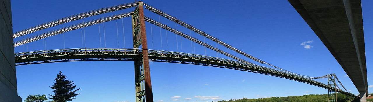
Engineering, architecture and heritage projects
We conduct precise and comprehensive 3D laser scanning services of open spaces, large infrastructures, buildings, environments, and objects. These scans are highly beneficial for project execution in various fields, including industry, architecture, heritage, and many others. During the measurement and planning phase of buildings, refurbishments, interiors, and outdoor installations, obtaining detailed and reliable measurement data is crucial. Accuracy and precise measurements serve as the foundation for robust planning and documentation. In the architecture and engineering sectors, simple 2D representations are inadequate in today's context.
In Scanphase we produce complete and information-rich 3D BIM models from point cloud data.

Marine 3D Laser Scanning & Modelling Survey
Laser scanning is accurate and thorough, being usable throughout every stage of the retrofitting process, including the initial feasibility assessment, the concept design, and the final detail adjustment phase. Laser scanners boast an accuracy rate of +/- 2 millimeters, enabling engineers to generate extremely precise data and therefore create optimally detailed three-dimensional images of whichever part of the vessel is to be retrofitted. In many cases, laser scans can be performed in a single day, and during smaller operations, such as BWTS (Ballast Water Treatment Systems) or scrubbing water system retrofits, laser scans can often be performed while the crew is still on board the vessel performing their duties, saving a great deal of time.

Scanning of complete buildings and drawing up plans
With 3D laser scanner we make the precise registration of all facilities and assets that will be used for mapping, as well as for the lifting of plans or updating existing ones. We use the market design tools Autodesk Revit, Autocad, Graphisoft Archicad, Navisworks, Solid Works, and others, with significant time and cost savings. Once the three-dimensional plane survey is done, we can offer 3D modeling of the scanned spaces for the creation of a BIM model.
When faced with the task of creating plans for an existing structure we know how difficult it can be. It is rare for buildings to have a simple form. Using a distance meter or measuring tape is a tedious and difficult job, which then has to translate into specifications on plans and trust that no mistakes were made or features were omitted.

At Scanphase we produce complete, information-rich 3D BIM models from point cloud data. Our Scan to BIM services are used due to our long-term experience of working on point cloud modeling projects. We have a team of Scan to BIM architects, engineers and modelers with experience working on complex renovation projects. We have worked on the renovation and restoration of heritage buildings, Government, Industrial facilities, old commercial properties, residential apartments that need to be demolished or updated with newer designs. Scan to BIM modeling services are extremely helpful in achieving excellent renovation results in less time and cost compared to traditional methods.

3D Laser scanning in shipbuilding
The use of laser scanning in shipbuilding is a technology that helps shipyards deliver projects faster, more efficiently and with less risk. We are a company that specializes in quickly and accurately capturing current conditions, using the latest proven technologies in laser scanning and precision elevation, to achieve best practices for boat repair and new construction.
Scanphase collaborates with naval companies and field specialists and offers high quality services for shipping companies in all European ports including Portugal, France, Italy, Spain, Malta, the Netherlands, Germany, Belgium, Turkey, and North Africa.
The key to competitive utilization lies in being able to capture the "running" vessel in 3D quickly, accurately and inexpensively.
_JPG.jpg)
Reverse engineering projects
The 3D laser scanner is highly suitable for reverse engineering purposes. It captures detailed data, projecting a three-dimensional image of the scanned object. This capability enables the creation of virtual assemblies, facilita- ting the identification of overlaps and ensuring precise piece fittings.
A 3D scanner is employed to scan and analyze a real-world object or envir-onment, gathering data regarding its shape and potentially its visual attributes such as color and texture. This collected data serves as the foundation for constructing a 3D digital model.
These models find applications in gene-rating customized drawings or in the production of spare parts. Additionally, we conduct analyses to determine suitable 3D printing or machining solutions based on your specific needs and the materials required for the piece.

3D BWT (Ballast Water Treatment) scanning projects
The key to competitive utilization lies in being able to 3D capture the vessel "in operation" quickly, accurately and inexpensively. The early availability of detailed and accurate 3D studies from laser scan data allows shipyards to get ahead in planning the project, designing the refurbishment, and acquiring materials ready to start work as soon as the ship arrives at the repair dock. The use of scanning helps to shorten downtime.
Scanphase offers an extremely fast measurement process and offers an accurate 3D laser scanning of the network pumps and pipes critical to the BWT (Ballast Water Treatment) system so that engineers can:
-
Agree on an efficient ballast water management plan
-
Accurately implement the BWT plan
-
Easily install BWT system
-
Keep complete records of the area of interest.

Yacht laser scanning for fast and accurate retrofit
Laser scanning is truly revolutionizing the yacht building industry by increasing quality and efficiency for a range of stakeholders. From planning to building and furnishing, laser scanning provides a reliable solution when it has to be right.
By their very nature ships are generally expensive to transport for scanning. Our 3D engineers sets up equipment on-site and have the ability to move between rooms and then join scans together to create a design layout to high accuracy in 3D interior space is possible. Coupled with existing external ship design, creates a cohesive whole. colorized 3D point cloud scans and panoramic images allows to see the yacht data in ways previously not possible. It is important to understand that a 3D scan is the first part of the Computer Aided Design (CAD).

Georeferenced points clouds
Point clouds have become increasingly prevalent in the generation of 3D models, notably beneficial for projects involving Building Information Modeling (BIM). Geographical referencing is a pivotal task for those aiming to incorporate point clouds with real-world coordinates into their models.
Ensuring a proper geographical reference for point clouds involves transforming them using Ground Control Points (GCPs) or situating them within a defined coordinate system.
The geographic references of point cloud data can be integrated into various platforms such as Faro Scene, AutoCAD, Navisworks, Autodesk Revit, Civil 3D, Graphisoft Archicad, and many more. These platforms facilitate the seamless utilization and integration of point cloud data into the project workflow, ensuring accurate and geographically referenced 3D models.


Specialized 3D scanning solutions cater to a wide range of professional fields, including architecture, engineering, industry, art, audiovisual communication, and more.
Our advanced technology empowers professionals to explore and expand applications that were previously confined to conventional methods, resulting in significant time and cost savings.
The utilization of laser scanners and 3D scanners is paramount in industrial metrology. The ability to create highly detailed and accurate virtual models, replicating the original with precision and in high resolution, revolutionizes various disciplines.
Our technology enables the capture of intricate details, ranging from minute elements to expansive infrastructures spanning hundreds of meters. We provide our customers with tailored deliverables, including point clouds, polygon meshes, or digital models, depending on their specific requirements.